Loughrigg Terrace via Loughrigg Tarn Walk
Number 2 in ‘The Sally’s’ series of walks
Easy – 7.3 Miles
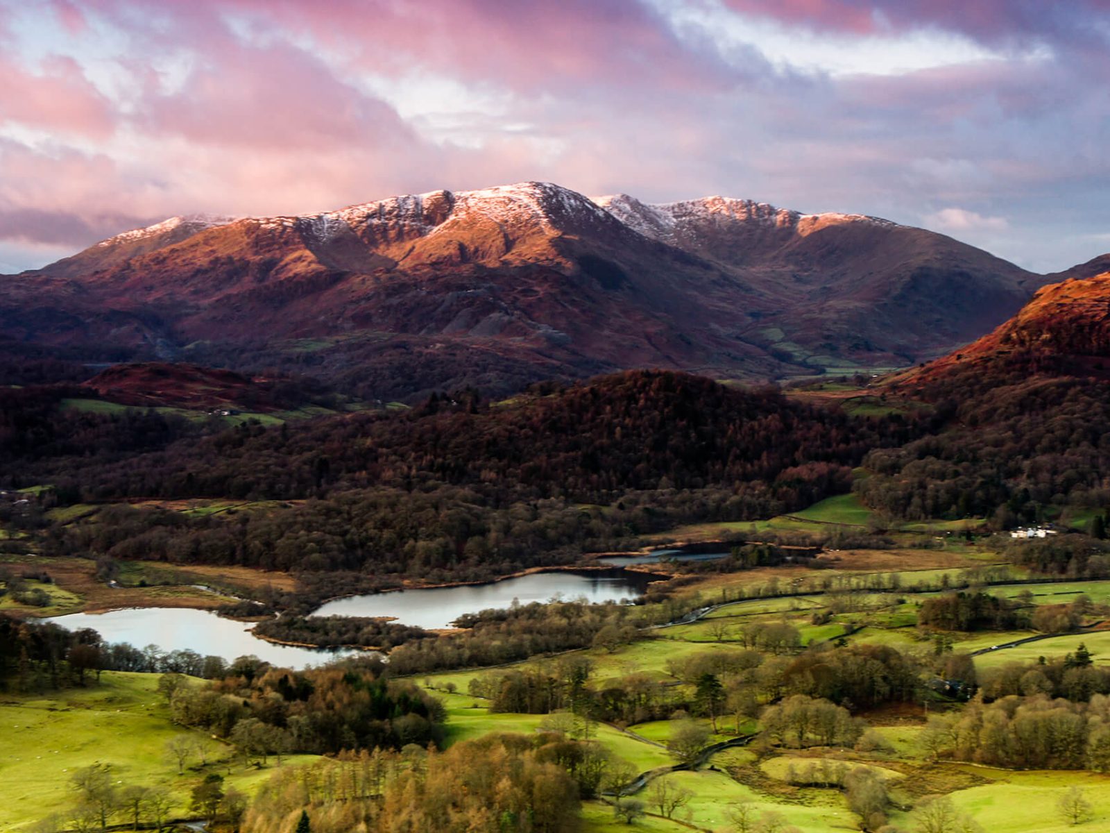
You don’t always need to walk up the steepest hills to appreciate the beautiful Lake District views, this walk takes you to the other side of Loughrigg without the climb. Along the way you will see the fantastic view of the Langdale pikes, Helm crag and Windermere.
From the Post office and Tourist Information office at the top of the town centre, head towards the Climbers Shop and in front of it turn left into Compston Road. In 100m, about half-way down the road, turn right into Millans Park, then immediately left into Vicarage Road, signposted “Rothay Park” and “Loughrigg”. Follow the lane past the church and school into Rothay Park and keep straight ahead on the tarmac path.
Reaching the railings leave the park over the small bridge in front of you and then just beyond turn left over the stone arch Miller Bridge to the Under Loughrigg tarmac road. Turn right along the road to cross the cattle grid, and in less than 100m turn left signposted “public bridleway”. This tarmac lane immediately heads steeply up the hill. Above the buildings the road turns into a rough track, with a couple of gates.
Eventually you reach the open fell side. Continue on the track, ignore side turnings, and keep on the obvious track. With the climbing done, continue on, a wall comes in from your left, with Loughrigg Fell above to your right. Rounding Ivy Crag you are presented with a good view down to Skelwith Bridge. Bear right on the higher path for a viewpoint with bench. Continue along the track above the wall. Another wall joins to your right and the narrows at a gate.
Go through the gate and bear left. Drop down to the minor road at the bottom of the track, go through the gate to the road in front of the cottage. Immediately turn right, through another gate onto a smooth gravel road. Within 200m Loughrigg Tarn comes into view. You can drop down to the tarn but come back up to the road in front of the cottages at The How. Pass in front of the cottages on the track.
Just beyond the cottages the road sweeps right and then left, after which look to your right for a wooden gateway in the wall. Climb up to the gate, go through and turn left as indicated by the footpath marker. Follow the path up beside the wall, at the strange gap in the wall bear right to stay above the wall. A track continues alongside the wall, and gradually reverts to a narrow path. Cross the ghyll and carry on the path, at the end of the wood go through the gate into the field.
Continue on the path and above the cottages the path bears left slightly to drop down to the road. There is a stile, and gate to the road. At the road turn right. Reaching High Close Gardens continue along the road and just before the top, just past the junction, bear right to a gateway. It is signposted public bridleway, “Loughrigg Terrace” and “Rydal”.
Drop down the path to the terrace where the views over Grasmere open out to the many fells beyond. Continue along the terrace, reaching the wall, bear right and drop down a little. Opposite the wooden gate where the track splits bear right onto the permissive path. This higher level track traverses the fellside round to Rydal Cave. This man-made cave is always worth a visit.
From the cave, carry on along the path dropping down now towards Rydal Water. Don’t drop down to the water’s edge, remain on the higher path, and continue to the wooden bridleway gate. Go through into the lane and continue along this lane with moss covered walls. It soon becomes tarmacked and passes some cottages and Cote How tearoom.
Drop down to the stone arched Pelter Bridge. Do not cross the bridge, but turn right along Under Loughrigg, this is a quiet minor road. With the River Rothay on your left, continue along the road back to Miller Bridge. Cross the bridge and go through the park back into the town.