Gummers Howe
4.0 Miles
From the car park turn right, uphill along the roadside for a little more than 100m.
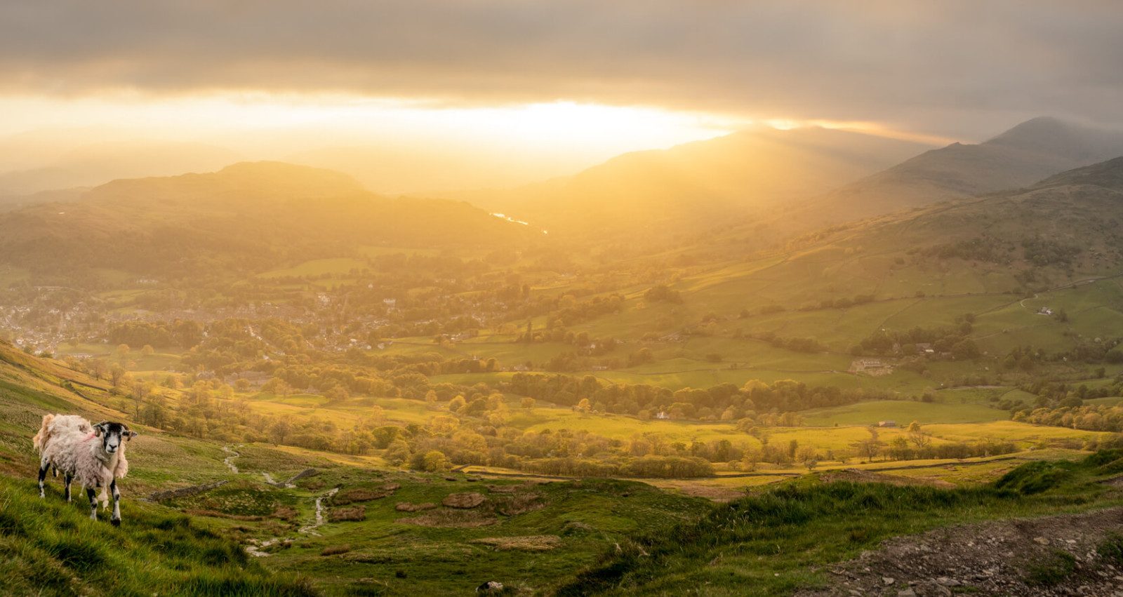
1) Turn left through a gate signpsted ‘public footpath Gummers How’. From the excellent path there are superb views down to Lakeside at the foot of Windermere and to a whole array of mountains beyond, the Coniston Fells being particularly prominent. The track passes through light woodland, with abundant silver birch. Cross a small stream before starting the rise to the summit, mainly on a well constructed natural stone stairway.
2) At a junction a little way below the summit there is a choice of path; the direct route goes straight ahead, involving just a little mild scrambling (if the short walk option is taken this is the preferred upward route). A diversion to the right circles below the summit, easy and without scrambling, bearing round to the left to reach the peak, with its shapely little column. (For the short walk this is the recommended return route).
3) To continue the full circuit head just a little east of north from the summit. There are several grass paths, none of them reliably continuous, which seem to be heading in more or less the right direction. The objective is a ladder stile over a cross wall, close to a farm gate, a little more than a half mile from Gummer How. Before reaching this stile a derelict wall is crossed and the path soon becomes better defined, heading for woodland.
4) Go over the stile; through the woodland the path is generally clear on the ground, never far from the busy little Burrow Beck.
5) Reach a cart track. Turn right to cross the beck to a signpost. Follow ‘Cartmel Fell’, rising quite steeply up the valley side. Go straight ahead at a junction to continue rising. Go left at a waymark on a post, still rising, going straight ahead at further waymarks. There are now long views over much of the comparatively soft ‘Silurian’ farming landscape of southern Lakeland. The track narrows, with a section by the side of a wall. Cross a stream, then another stream, with mini waterfalls. Go over a waymarked stile, pass the remains of an old wall and continue along a delightful path, including a section boardwalk.
6) At a waymarked junction there is a small ruined building to the left. Go straight ahead, cross a stream and continue to a gate/stile giving access to the public road.
7) Turn right to walk by the side of the very quiet road for almost one and a half miles to rejoin the outward route at point 1 and return to the car park.